Total Pageviews

Wednesday, June 14, 2017

DAWSON CITY, YT to ALASKA - June 7 - 10

GOLD RUSH
Dawson City was the epicenter of the Klondike Gold Rush when gold was discovered in 1886 on Bonanza Creek.  This historic town is at the confluence of the Klondike and Yukon rivers.  By the time the ice thawed on the Yukon River in May 1898, 30,000 prospectors and fortune hunters from around the world had arrived in Dawson turning it into the largest city north of Seattle and west of Winnipeg.  Today, historic Dawson is a small town with about 1,900 residents, 13 bars, several restaurants and hotels.  While gold mining is still a part of the Dawson area, most mining is done by individuals on small claims that have been passed down in families.

Gold seekers who survived the grueling trek over the Chilkoot Pass to Dawson found most of the claims had already been staked.  Although many were disappointed, fortunes were made by enterprising men and women who opened businesses to supply and entertain the prospectors coming in from the gold fields.

We spent a day exploring Dawson by driving around, taking a couple of tours, checking out a couple of restaurants and going to a show at Gold Tooth Gertie's.
Dredge #4, built in 1912, mined the Klondike River Valley until 1960.  It's the largest
wooden hulled bucket line gold dredge in North America.  Now a National Historic Site, it's open for tours.  


There's all kinds of stuff at Jimmy's Place.
Many of the buildings in Dawson have been restored or replaced with replicas. 
The unpaved streets and boardwalks add to the historic feel of Dawson.


During our walking tour, Arizona Charlie, a character from the 1890's, told us about
 his adventures and enterprises during his days living in Dawson during the Gold Rush.
Prospectors would bring their gold to the bank, where is was weighed and exchanged for paper money.


One of Arizona Charlie's "gold mines" was the Red Feather Saloon.

Dinner at Klondike Kate's was excellent.
Dome Mountain is the highest point above Dawson City.
It was a full house at Gold Tooth Gertie's where gambling, drinking, and can-can dancers entertain.
TOP OF THE WORLD HIGHWAY - HELL-o Alaska! - June 8 - 11
Leaving Dawson, we took the short-cut to Alaska via the Top of The World Highway.  We crossed the Yukon river on a ferry then started driving on Highway 9.  The Top of The World Highway is a wide gravel road winding it's way atop the mountain ridge.  The border station is at Poker Creek, Alaska where the gravel road turned into smooth as silk pavement; welcome to the United States!  After 9 miles of blissful driving conditions, the highway suddenly turned to SH...shall we say a horrible mess, making us slow down to 10 mph in the extremely scenic and dangerous Goat Trail section of the highway.  The Goat Trail (as the locals have named it) is mainly 1 lane with a 1,000 foot drop to the river valley.  With no guard rails and soft shoulders, I kept my eyes shut most of the time while clenching my jaw and other body parts.  Jim did an excellent job driving white knuckled and getting us safely to Chicken, Alaska where we stopped for lunch and to recover and unclench before getting back on the bumpy, bucking road out of Chicken to Tok, where we hooked back up with the Alaska Highway.
We got in line at the ferry at 8:45 a.m. with 12 RV's in front of us.
At 10:30 a.m. we boarded the ferry. 
We're on top of the world, eh!
The border crossing at Poker Creek, Alaska is the most northerly U.S. land border.
Ahh, beautiful smooth pavement.
Not really, just had lunch.
TOK - June 9 & 10
We arrived at the Sourdough Campground and had to ask ourselves "is this Alaska?"; the temperature was 92 degrees!  Everything was very dry and Smokey the Bear was telling us the fire danger was Extremely High and there was suspension on all burning.

Alaska recently legalized marijuana and the joke is: The capitol of Alaska will be moved from Juneau to Tok.  Ha Ha.  

June 10th we celebrated our 34th wedding anniversary by cleaning the Jeep and RV inside and out as the dirt and dust from the roads had put a gritty layer of dirt over everything.  After working all day, we got our sweaty bodies cleaned up and went out to celebrate our anniversary at Fast Eddies restaurant, which was 1 of 3 restaurants (including a food truck) in Tok.  The halibut and salmon we ordered were delicious.

June 11 we woke up to pouring rain and cooler temperatures.  Packing up in the rain, we got on the Tok Cut-Off Highway and headed for our next adventure in Valdez.

Monday, June 12, 2017

ALBERTA, BRITISH COLUMBIA, YUKON TERRITORY

THE ROADS - June 3-8

Our camping neighbors at Pocahontas were from Edmonton and assured us we would have no problem taking the scenic Big Horn route highway 40 to Dawson Creek.  Highway 40 was a 2 lane paved road winding through the mountain wilderness of eastern Alberta.  We spotted serval black bears, caribou, a moose with a calf, and even a grizzly bear!

THE ALASKA HIGHWAY 
On September 28, 1996, a ceremony in Dawson Creek designated the Alaska Highway
 as the 16th International Historical Civil Engineering Landmark.
The Alaska Highway starts at Mile "0" in Dawson Creek, BC and ends at Mile 1523 in Fairbanks, Alaska.
A LITTLE HISTORY
Prior to the bombing of Pearl Harbor in 1941, there was no road to link Alaska with the Lower 48.  With the start of WW II, Canada and the U.S. agreed it was a military necessity to construct a supply road to defend North America against the Japanese.  The two countries reached a formal agreement that stipulated that the U.S. pay for construction and turn over the Canadian portion of the highway to the Canadian government after the war ended.  Canada furnished the right-of-way, waived import duties, sales tax, income tax and immigration regulations, and provided construction materials along the route. 

Construction of the highway began on March 8, 1942 and was completed just eight months later.  It took the efforts of 11,000 American troops and engineers, 16,000 civilian workmen from Canada and the U.S., and 7,000 pieces of equipment to penetrate the 1,500 miles of wild mountain terrain.  Living in primitive mobile camps, the men worked 7 day a  week in temperatures as low as -70 in the winter and summer heat in the 90's, as well as enduring relentless mosquitoes, mud, dust, and little food as they bulldozed thorough the wilderness laying down eight miles of road per day.

Since taking over their portion of the highway, Canada has replaced the bridges and hastily constructed road.  The brutal climate causes frost heaves, and potholes.  Constant maintenance is required to keep the highway open year round.
  
Summer road and bridge work along the Alcan never ends.
Where the pavement is torn up, dust and mud make quite a mess.

The caked on mud was about a 1/2 inch thick.
Most of the campgrounds have pressure wash stations to clean up after a day on the road.
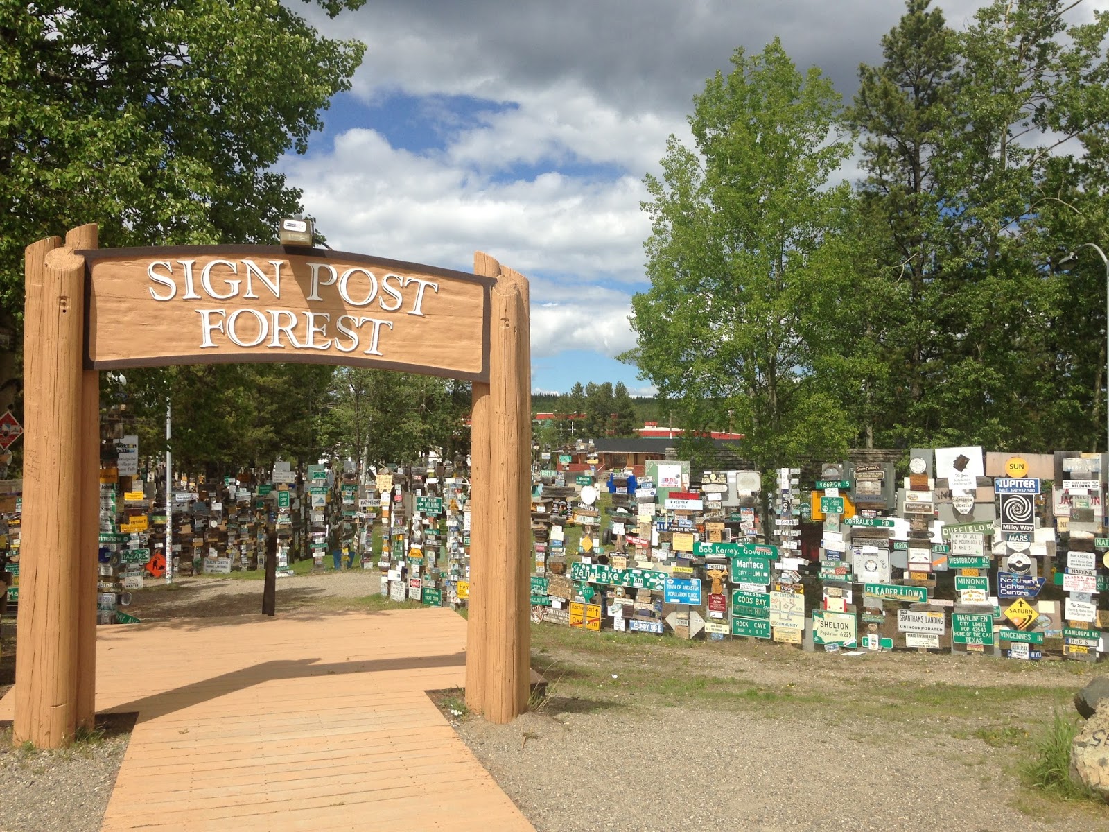
MILE 635 - WATSON LAKE, YT - Sign Post Forest
Watson Lake was an important point during the construction of the Alaska Highway. The airport, built in 1941, was a major refueling stop along the Northwest Staging Route.


The tradition of putting up a sign was started by a U.S. soldier working on the Alaska Highway.  A personal sign can be dropped off at the Visitors Center where it will be added to the growing collection.  We saw signs from all over the world.
At the end of every September, the number of signs in the "forest" is updated.
As of September 2016, there were 83,885 signs.
Road building equipment from the 1942 road construction project is on display at the Sign Forest.
MILE 918 - WHITEHORSE, YT
Like the Klondike gold rush stampeders of the the late 1800's who landed in Whitehorse to repack their supplies, we did the same with a visit to the grocery store.  Leaving the Alaska Highway we averaged 45 MPH as we bounced along the scenic, potholed, frost heaved Klondike Highway on our way to historic Dawson City, Yukon Territory.
Our campsite view at Toad River.
Watch out for Stone Sheep on the highway!
Wood Bison graze next to the highway.


Sunday, June 4, 2017

OH CANADA! June 1 & 2


It was without incident we passed through Canadian customs and inspection at the Carway, Alberta station.  Canada doesn't seem as fussy about who they let into their country.
With the mountains west of us, the landscape was rolling hills with lakes and streams.

BANFF AND LAKE LOUISE - June 1 & 2
Mid-afternoon we arrived at Tunnel Mountain Provincial Campground in Banff.  Nestled in the Canadian Rockies, Banff is a popular tourist town with 2.5 million visitors each year; in the summer for the scenery, and in winter for the skiing.
Village of Banff has a ton of restaurants and shopping opportunities.
One of most scenic areas north of Banff is Lake Louise.  
Ice still on the lake.  
Victoria Glacier above Lake Louise.
Canoe rentals!
The color and clarity of the water makes this lake a real gem.
Sitting on the shores of this jewel is the Chateau Lake Louise.
The bride is setting up the shot and directing the groom for a selfie photo shoot.
The groom has a remote to click the camera.
He seemed to take directions well from his bride and did what he was told to do.
He already has this marriage thing figured out.
HIGHWAY 93 NORTH - THE ICEFIELDS PARKWAY
One of the most scenic drives in North America is the the route between Banff and Jasper in the Central Rockies.  This year Canada is celebrating the 150th anniversary of the Provincial Park system, and to celebrate they are providing complementary park passes! 
In addition to fences along the highway, landscaped skyways were built
 over the Parkway to allow wild animals safe access to the other side of the busy highway.

Weeping Wall Waterfalls
Melting snow finds its way through cracks in the rock resulting in a series of beautiful waterfalls.
Columbia Ice Field
The glaciers visible from the Parkway cover 241 square miles.  
Late afternoon we checked into the Jasper/Pocahontas Provincial Park.  After getting settled we drove a few miles up the road to relax in the Miette Hot Springs.  Several pools are fed with water flowing out of natural hot springs.  The temperatures varied between pools with the warmest at 104 degrees and the coldest...really cold.

A popular place to hang-out and relax.


Saturday, June 3, 2017

GLACIER NATIONAL PARK - May 30 - 31


The beginning of the tourist season has barely begun at Glacier National Park.  Not all of the facilities are open, and The Road To The Sun which winds its way through the stunning mountain vistas connecting the east and west sides of the park was still closed.  A Park Ranger said crews are working to clear snow off Logan Pass and expects the road will open the end of June.  

By the way, if seeing the glaciers at Glacier National Park is on your Bucket List, you might want to visit soon as scientists predict the remaining few glaciers will be gone by 2030.
Grinnell Glacier is quickly melting.
A CAMPSITE WITH MILLION DOLLAR VIEWS
We stayed 2 nights at Johnson's of St. Mary campground.  This family owned campground/cafe/motel began in1950's.  
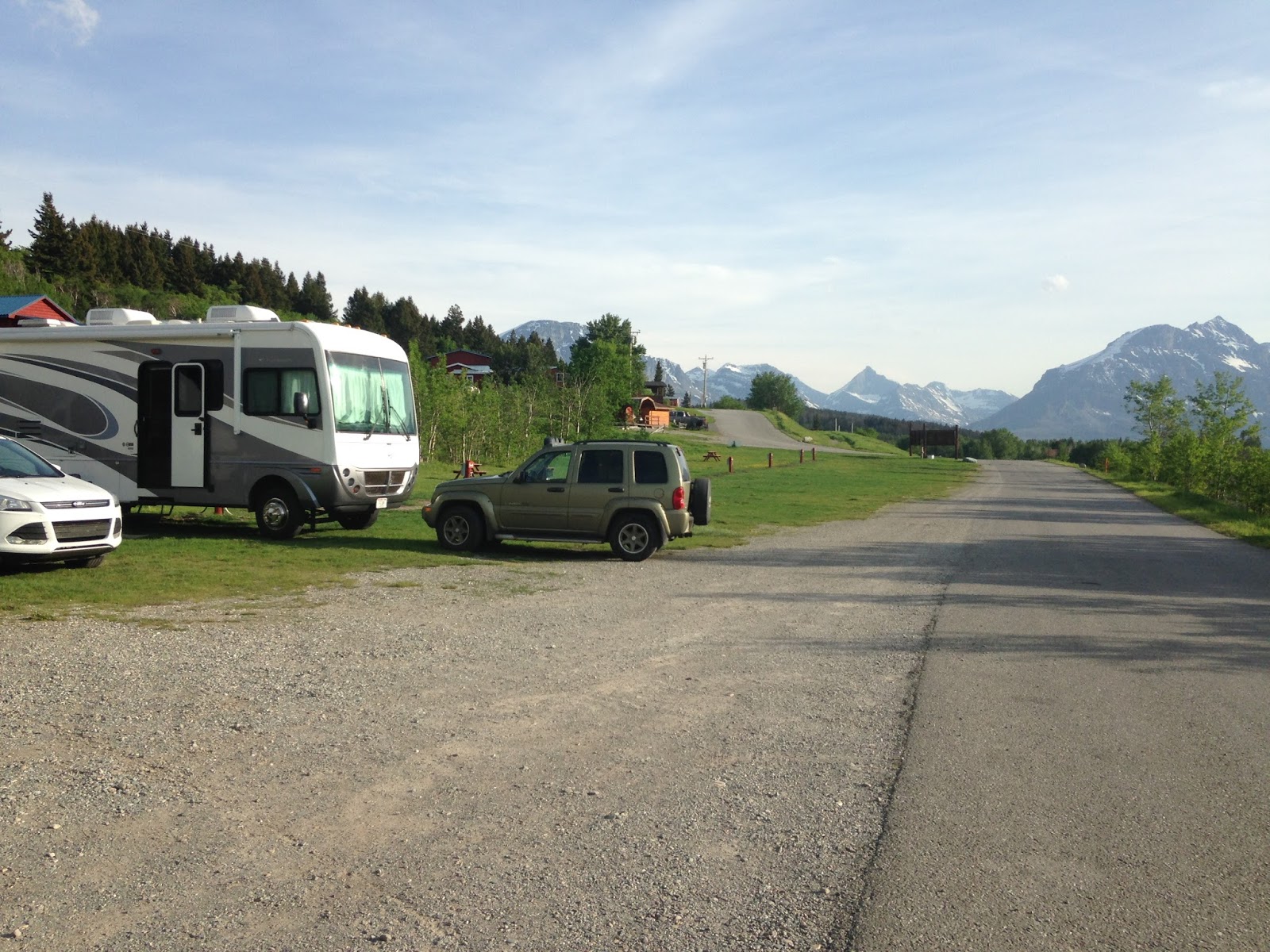
We had views of the mountains and a view of St. Mary Lake; doesn't get much better!
TODAY IS MY BIRTHDAY...WE'RE GOING TO HAVE A GOOD TIME - May 31
We drove to Many Glacier area of the Park with the plan of exploring, hiking, and having a birthday lunch or dinner at the historic Many Glacier Lodge.

At the Swift Current Lake trailhead, a woman just coming off the trail said she and her husband had spotted two grizzly cubs on the trail, but didn't see their mama.  Another hiker reported seeing the mama bear.  Now we started to have second thoughts about hiking this trail, until a couple of fellows, who were also hesitating at the trailhead, asked us to join them to form a bigger group...safety in number, I guess.
We are carrying big sticks, but note to self:  Leaving the bear spray
in the RV will not  help you if you meet a grizzly on the trail.
Our fellow hikers were locked and loaded with bear spray.
We followed closely behind them.

Hiking over the snow at an avalanche chute was exciting. 
Delicate spring flowers brightened up the trail.
After surviving the beautiful and uneventful hike, we were starving and ready for lunch.  It was a disappointment when we got to Many Glacier Lodge and found out it was closed.  There was a flurry of activity at the lodge as workers prepared for its summer season opener on June 12th.  
Many Glacier Lodge on the shores of Lake Josephine.
BIRTHDAY DINNER - PLAN B
The cattle Barron Supper Club, located 8 miles from the campground in Babb, was open and I chose as the place for my birthday dinner.  When we arrived, we discovered the supper club wouldn't open for another week but the Bar/Grill was open and we could order from the dinner menu.  I ordered a celebratory martini, and was told the liquor hadn't come in yet, but they had beer and wine; ok, I'll have a glass of wine!  Steak and seafood are the specialties at the Cattle Barron; I love seafood!  Oh, the shipment of seafood was coming next week; ok, I'll have a steak! 
The perfect place, with my perfect man, to celebrate a wonderful birthday.

Thursday, June 1, 2017

NORTHERN PRAIRIES May 27 - 29

NORTH DAKOTA - May 27
Getting on Highway 2 in Grand Rapids, we headed west to Langdon, ND.  Being it was Memorial Day weekend I was concerned we'd have a problem finding camping spots over the weekend so we stayed in Langdon two nights.  As we drove west across the windswept flat prairie of northern North Dakota, we were entertained by Garrison Keillor reading his book "Pontoon" with it's cast of colorful stoic Norwegian characters in the town of Lake Woebegon.  We chuckled at lot, and I dozed off a few times listening to Keillor's melodic voice.

The flat and desolate North Dakota prairie seems endless.
 The Norwegian version of Mexican food can be found at the "OOF-DA" taco truck.

PEACE - May 28
We stopped at the International Peace Garden located on the Manitoba/North Dakota border.  The botanical garden was built on the 49th Parallel in the heart of the North American continent as a symbol of peace that reaches across the longest undefended border in the world.
The unveiling and dedication of the cairn on the 49th Parallel was July 14, 1932.
The cairn reads:  "To God in His Glory, we two nations dedicate this garden and pledge ourselves
that as long as men shall live, we will not take up arms against one another".
The gardens were just starting to bloom with spring flowers and preparations were underway for the planting of annuals.

A beautiful symbol of peace.

The wind from the northwest was relentless with strong gusts pushing the RV around and making driving a tiring ordeal.  We pulled off the road for a night at the Roughrider RV Park in Minot.

MONTANA! - May 29
The landscape in northeast Montana isn't a whole lot different from North Dakota's; oil rigs dotting the expansive prairie as well as seeing farmers planting the enormous fields.  With Keillor's book finished, we changed it up and put on an action suspense story, "The Last Detective" by Robert Crais.  

The wind let up today and we made it to Havre, MT for a one night stay at the Havre RV Park.  The location was in a parking lot adjacent to a Conoco Gas Station/Bar/Casino and is situated between Hwy 2 and the busy BNSF railroad yard and tracks.  I wore ear plugs to bed and got up when I saw daylight peeking in along the sides of the window blinds.  Unfortunately, the light I saw was from the seemingly thousand street lights surrounding the parking lot.  Up and at 'em, we got an early start toward out next destination, Glacier National Park at St. Mary, MT.

Yup, I do occasionally drive the rig although when I do it's somewhat stressful for Jim.

Our first sight of the Rocky Mountains...about 95 miles away!