Total Pageviews

Thursday, October 17, 2013

MAJESTIC, MAGICAL & MYSTICAL

Crescent City, CA - Oct. 11 & 12
REDWOODS
Leaving Oregon, we drove southwest to Redwood National and State Park.  As Hwy. 199 brought us closer to Crescent City, CA, majestic redwood trees lined the sides of the highway and formed a canopy above us.  We camped 2 nights at the Village Inn RV Park underneath a towering redwood tree.
I'd hug this big boy but I can't get my arms around him.
Saturday we drove south on Hwy. 101 going in and out of the redwood forest and along the coast to Trees of Mystery.  This privately owned tourist area (trap) has trails through the forest with interpretive stops along the way.  Some of the trees are estimated to be 3,000 years old and some as high as 600 feet.  We took the gondola to the observation deck at the top of the ridge.  The views of the back country to the east, and the Pacific to the west were spectacular.
After Paul and Babe left Minnesota they moved to California to log the Redwoods.
Sky Ride over the tops of the trees.
Another enterprising land owner made a tunnel through this tree and charges $5 to drive through.
Because the Redwood National and State Park is owned by  both the state and fed, it wasn't shut down so we took a primitive one-lane road through the park, stopping from time to time to walk around and marvel at the massive size of these ancient trees.  The air in the forest smells so clean and pure, I wish I could bottle it.
 
Majestic and Magnificent

PLAN B - Oct. 13 - 16
Our original plan was to visit Yosemite National Park after seeing the Redwoods, but Yosemite is shut-down so we need to have a Plan B.  Jim suggested we head east to Mount Shasta.  Sunday we left the Pacific coast and drove east on the winding and twisty mountain Highway through the Trinity National Forest.  Our average speed was about 35 mph and it took us 3 hours longer than we had planned to reach Mount Shasta City.  By the time we got to our campsite at Lake Abrams RV Park, it was cocktail hour and we both were ready for a Manhattan.

MAGICAL AND MYSTICAL
We soon met other campers and long-term residents at the campground.  Many had come to the area to experience the spiritual, metaphysical, and energetic aspects of the mountain and surrounding area.  We had some interesting conversations with some of our fellow campers about the powerful energy and spiritual nature of Mount Shasta, the hot springs, lakes, and vortex sites surrounding the mountain.
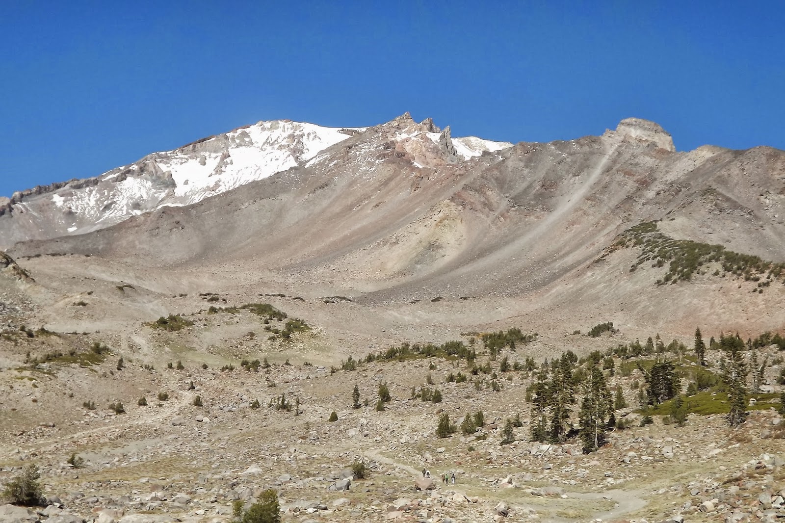
The view of Mount Shasta from Lake Siskiyou.
WERE HEAVEN MEETS EARTH
Mount Shasta is over 14,000 feet high, and is said to be one of the 7 sacred mountains of the world.  On a clear day Mount Shasta can be seen from Crater lake which is 150 miles away.

Monday we drove up over 7,000 feet on the southwest side of the mountain.  There are several places to park at trailheads and hike on the many trails through the forest.  Apparently, the Shasta-Trinity U.S. Forest Service Employees are a little rebellious and didn't quite buy into the whole shutdown thing, as the gate was open, as well as the bathrooms unlocked.  The road ends at the Old Snow Bowl and is a popular starting point for those adventurous souls who attempt to climb to the summit.  Only 1 in 3 climbers succeed in reaching the top.
Map of routes to the summit.

The Old Snow Bowl
Labyrinth at the Old Snow Bowl area.
Labyrinth in the foreground, Old Snow Bowl in the background. 
We spent some time shopping and exploring the free spirited town of Mount Shasta City and couldn't help but notice how everyone we met was smiling, friendly, respectful, and just plain happy to be there.  The loving and peaceful energy here is almost palpable.  I noticed that all my senses seemed more alive; colors more vibrant, sounds clearer, sense of smell more distinct, and even the taste of food burst with more flavor .

As annoyed as I've been with the government shut-down, and disappointed with their closing national parks and monuments we wanted to see, I'm now grateful that we had to go to Plan B and took the detour to Mount Shasta.  This was a truly memorable and unexpected experience.

Monday, October 14, 2013

MORE SHUT-DOWN AND OREGONIANS

A BEND IN THE ROAD - October 8
We left the stunning ocean vistas of the west coast of Oregon and traveled east to Bend.  Driving over a mountain pass we ran into snow.  We have heard nothing but rave reviews of the beauty of Bend's snow capped Mount Bachelor, and the 300 days of sunshine they receive each year.  Unfortunately, we managed to visit on the few days that the sun wasn't shining; it was raining, and the mountains were covered in clouds.  We stayed one night and moved on south to Crater Lake hoping that the government shut-down would be over and we'd be able to visit Crater Lake National Park.

RIVERS, VOLCANOS, AND LAKES - October 9 & 10
We stayed 2 nights in the little mountain town of Prospect at the Crater Lake RV Park.  Prospect is in the middle of the national forests with the Rouge River running through the area.  Since the government shut-down was still going, we weren't able to see Crater Lake, but did see Diamond Lake, waterfalls, and evidence of the volcanic action that took place over 7,000 years ago and formed the stunning and magnificent sights in this area.  We hiked  past several "closed due to government shutdown" signs to several waterfalls, and along the Rouge River Gorge where the river runs through a lava tube and forms a natural bridge. 
The highway was open but the gate to the entrance of Crater Lake kept us out.

Rouge River Gorge

The Natural Bridge

Even the pit toilets were locked up.  We met a woman on the hike along the river gorge who said "well, if I didn't have to go to the bathroom before, all this rushing water is making me want to go now".  Behind the restrooms, there was "evidence" of people who had to "go".  We were sorry for the inconvenience too. 

A lovely spot for a picnic over-looking Diamond Lake and distinct volcano, Mount Bailey.

They even furloughed, wrapped, and tied up poor Smokey the Bear.
 He isn't allowed to tell people "Only You Can Prevent Forest Fires".
LAUGHING WITH THE LOCALS
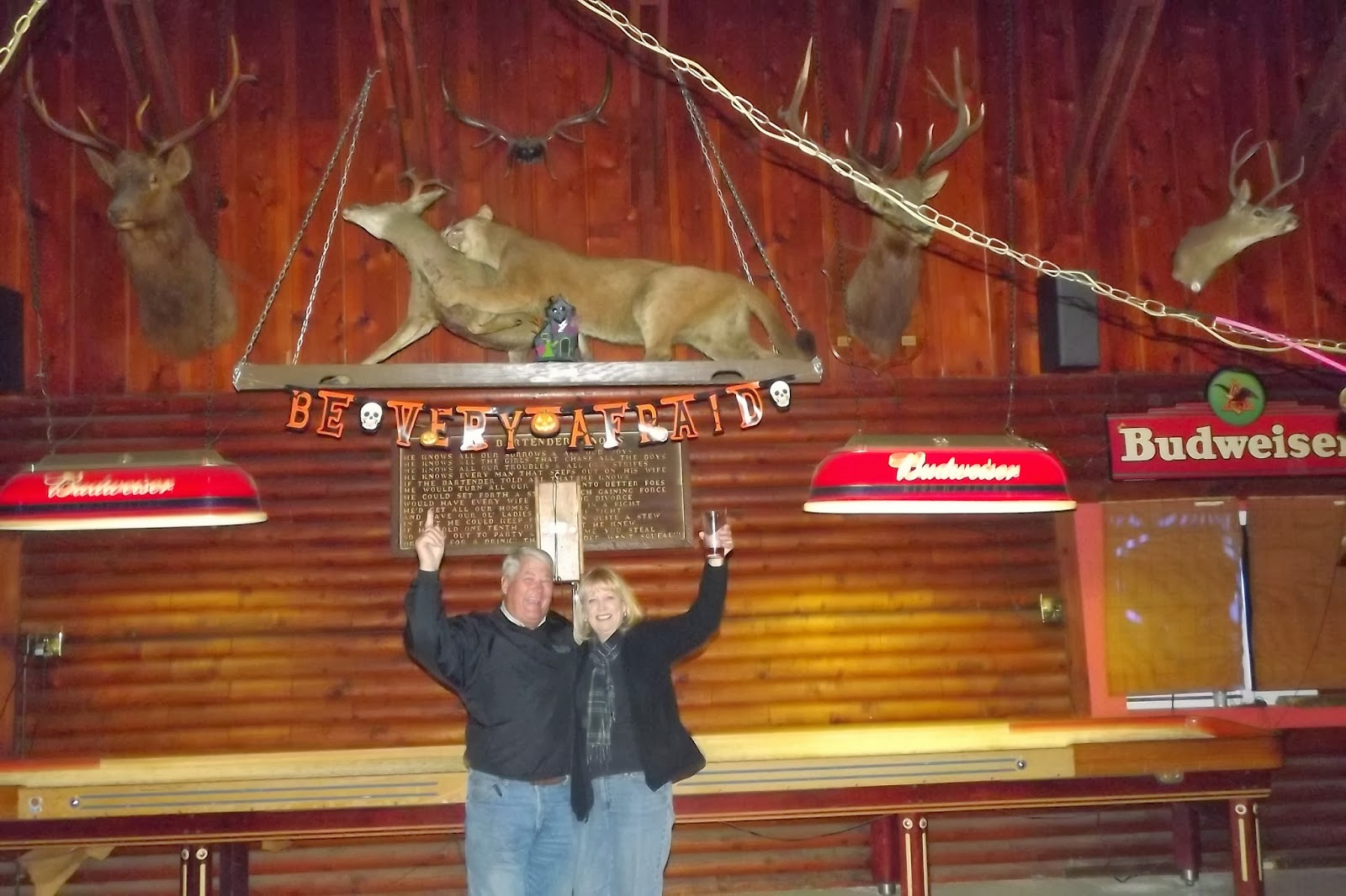
Prospect's only bar, The Trophy Room, had comedy night on Thursday.  We showered, put on some clean blue jeans, and headed out for a night on the town.  About 25 locals (some furloughed forest service employees) showed up to listen to Chris, the comedian, who had come all the way from the big city of Eugene.  He started his show by asking if we wanted to hear the "clean" show or the "dirty" show.  The crowd shouted "DIRTY", so I won't be repeating any of his jokes or stories.  He was funny and we enjoyed a lot of laughs, some brews, and conversation with the locals and their take on the government shut-down.  One thing I have to say about the Oregonians we've met on this trip, they are friendly and generous.
Chris: "Hey, Jim and Connie did you hear the one about..."

Cheers from The Trophy Room
Tomorrow we leave for Crescent City in Northern California to see the redwoods.

Tuesday, October 8, 2013

SCREAMING, SURFING, SEA LIONS, AND SIGNS

Central Coast - Oct. 6 - 7
 
I SCREAM, YOU SCREAM, WE ALL SCREAM FOR ICE CREAM!
Before leaving the Tellimook area we had to stop, one more time, and stand in line for an ice cream cone at the Tellimook Cheese Factory. 
YUM!
 
MINNESOTA SURFING
Stopping at the popular beach town of Ocean City, OR, we met a young woman from Minnesota.  When I saw a surf board on the roof of a car with Minnesota plates, we just had to ask..."where are you from in MN?".  She said she was from the little town of New Munich, near St. Cloud, but she has been out here for awhile.  We chatted with her saying a lot of "ya sures and you betchas", then said our good-byes and continued on to new sights.
Ocean City Beach and huge sand dune.

Surfers at Hay Stack Rock in Ocean City

Those little specks on the huge sand dune are people climbing up to run or sand surf down the giant dune.

CENTRAL COAST
We stopped several times at scenic vistas on our way down the Central Coast. The views of surf pounding the rugged rock cliffs and the sandy beaches along Hwy 101 is stunning.


Several Historic Landmark bridges, designed by Conde McCullough
in an Art Deco Style, cross the rivers flowing into the Pacific.
SCREAMING AT THE DEVIL
One interesting spot we stopped at was called The Devil's Punchbowl.  Waves come into this crack in the basalt rock and create some mighty fine wave and spray action.  This is a Federal site and should have been closed due the Government shut-down, but thanks to some local volunteers who decided to protect it from vandalism, clean the restrooms, and keep it open (with no entry fees being collected) we were able to get in to see this wild sight.
See the little specks of blue and green toward the bottom right side of the picture?
  A woman was taking a picture of two girls at the Devil's Punchbowl when the
 spray from a  big wave soaked them.  Their screaming was hilarious.

PARKING IN THE RAIN FOREST
We are staying 2 nights at the Carl G. Washburne State Park.  Although the sun is shining, it feels like we are in a rain forest with massive ferns, mushrooms and moss growing on everything.  We strolled down the 1/2 mile trail along China Creek through the lush forest and under the Hwy 101 bridge to the ocean.  I woke up in the middle of the night to the sound of rat-a-tat-tat on the roof and had to get up to retract our bedroom slide-in before the rain flooded us again.
Trail to the beach through the lush rain forest.

Logs piled up at the mouth of China Creek.

A GUIDING LIGHT - Oct. 7
Today we explored more of the Central Coast and stopped at Heceta Head Lighthouse, which is said to be the most photographed light house on the Oregon Coast.  This National Landmark is run by the State of Oregon and the U.S. Forest Service and is open for tours Memorial Day through Labor Day.  We didn't get a tour, but did walk around the grounds because the State of Oregon is still in business and not part of the Government shut down.
This beautiful Queen Anne style duplex was once the home of the
 former Lighthouse Keepers and their families; it's now a B & B.
 
The Heceta Head Lighthouse has been in use since March 1883 and is still in
operation although electric automation ended the need for lighthouse keepers.
SEA LION CAVE
One of the largest sea caves in the world is located on Oregon's central coast, and is the breeding ground and home to 80,000 seal lions (well, that's their story and they're sticking to it).  Before we bought our tickets we were told that the sea lions were out in the ocean feeding so we wouldn't see any of these huge animals in the cave.  It was still worth the trip down 200 feet in the elevator to the cavern which covers 2 acres, with a vaulted dome rising 125'.  We stood in this massive area seeing and hearing the waves rushing in and out of the cave.  Had there been sea lions lulling around, it would have been perfect.
View from the Sea Cave toward the Heceta Head Lighthouse
 SIGNS OF THE TIMES
Didn't get to see (or pay the fee) at the Oregon National Sand Dunes Recreational Area


Driving up and down the coast highway there are warning signs "Entering Tsunami Hazard Area"
and "Leaving Tsunami Hazard Area".  It's always good to know where the evacuation route is.
Debris from the Japan tsunami is no longer evident.  Pictures of the massive amount of stuff that made
its way to our west coast is unbelievable.  Thank you to the volunteers who cleaned up the beaches. 

Saturday, October 5, 2013

CRUISING AND DANCING ON THE NORTH COAST

North Coast, Oregon - Oct. 1 - 4

THE SHORT CUT
Leaving the Columbia River Gorge and eastern slope of the Cascade Mountains, we headed to the Pacific Ocean.  The sun came out, the scenery was beautiful, and our GPS guy did an amazing job getting us through the concrete spaghetti junction in Portland and Vancouver.  About 20 miles from Nehalem, the GPS guy took us on a short-cut, or as we call it "the cow path".  As we turned onto Hwy. 53 the road was narrow and as we were debating if we should, or if we even could turn around, I spotted a warning sign "Road Narrows Next 19 Miles".  WHAT!?  By now there was no where we could turn around and had no choice but to continue on the narrow, winding, and bumpy path they call a highway.
Logging on the right side of the road.  Lucky us,we didn't have to squeeze by any logging trucks.
NEHALEM STATE PARK
Our campsite backs up to the sand dunes along the Ocean; we can hear the crashing surf and waves.  We took a path over the sand dunes and walked the beach while the tide was out.
Heavy surf washed a lot of foam up on the beach.

Sittin' in the sea grass lookin' at the ocean...ahhh.

THE COLUMBIA RIVER BAR - Oct. 2
We drove north to Astoria through the driving rain and fog.  Astoria was once the salmon and tuna canning capital of Oregon...and maybe even the world.  The canneries went out of business when fishing boats started processing their fresh catch on board.  We spent a few hours at the Maritime Museum learning about the treacherous and dangerous Columbia River Bar.  The Bar is not a place to kick back and order up a beer or other favorite beverage.  This bar is where the Columbia River meets the Pacific Ocean and the two bodies of powerful water collide causing numerous shipwrecks, death, destruction and all kinds of havoc.  As ships from around the world approach The Bar, specially trained Bar Pilots board the ships to safely guide them across The Bar and into the Columbia River so they can continue their journey up to the ports of Portland and Vancouver.
This bridge in Astoria spanning the Columbia River between Oregon and Washington is just
over 4 miles long and built to withstand wind gusts up to 150 mph, and river flow of 9 mph.
IF IT'S NOT ONE THING, IT'S ANOTHER
For several reasons, any day of sunshine is a welcome relief.  Last week, after a sleepless night listening to pouring rain pound the roof (sounds like rapid machine gun fire) we discovered that the bedroom slid-out leaks.  In the morning, Jim reached for the shirt and sweater he had thrown on the floor before going to bed and they were sopping, dripping wet.  Although the clothes soaked up a lot of the water, some of the carpet was drenched.  We got the carpet dried out, and have temporarily solved the problem by keeping the slide-out in while it's raining...which is just about every day.
Wet on the outside.  We're dry on the inside.
Also, the microwave quit working.  The fixit list is getting longer.

BRAKE DANCING - Oct. 3
We got in the Jeep and started cruising down the Coastal Scenic Byway - Hwy 101, passing through small fishing villages and stunning scenery along the way.  Our destination was Tillamook, home of the famous Tillamook Cheese Factory.  About 15 miles outside of Tillamook, Jim got a panicked look on his face and said "OH, SH*T, we don't have any brakes!"  OMG, and deja vu.  At least this brake failure event didn't happen in rush hour traffic like it did with the RV in Phoenix last year, and it didn't happen on some of those scary mountain roads we experienced earlier on this trip.  By doing a brake dance using low gear and the emergency brake, Jim finessed the Jeep into Tillamook without killing us or anyone else.  We found a Ford dealership and service center where Kelly, the mechanic, took a look and diagnosed the problem as a broken brake line and said "this isn't a Jeep town, and we'll have to order parts, but we should have it ready tomorrow."  We rented a car and left the Jeep with Kelly. 
"I'm not a happy camper".
Late Friday morning, Kelly called with good news...the Jeep was fixed.  We packed up, left Nehalem State park, picked up the Jeep, returned the rental car, and drove to Cape Lookout State Park where we'll stay the next few days.

Tuesday, October 1, 2013

COLUMBIA RIVER GORGEous

SNAKE RIVER - Sept. 23
On our way west to the Columbia River Gorge, we spent one night in Huntington, OR on the bank of the Snake River.  The Snake River is the largest tributary into the Columbia River.
Sunset on the Snake River
BOARDMAN, OR - Sept 24 - 27
The next 3 nights we camped on the bank of the Columbia River at the wonderful city park in Boardman, OR. 
Sunrise on the Columbia River
We took a day trip to Pendleton, OR and toured the Pendleton Woolen Mill.  This mill is the maker of the beautiful and high quality wool Pendleton blankets and fabric.  It's been in operation since 1910 and owned by the 6th generation Bishop family. 

 The day before we left Boardman, we saw a sign for "Fresh Columbia River Salmon".   That got our attention!  We found the fisherman campground and were told we were about 4 hours too late as they were all sold out, but to come back tomorrow at 11 a.m. and they'd have more fish.  The next day we got to the fishing camp at 11:05 and the only salmon they had left was a monstrosity that would have fed an army.  We said "thanks, but no thanks".  Bummer, no fresh salmon for dinner tonight...or so we thought.

MEMALOOSE STATE PARK - Sept. 27 - Oct. 1
Staying in Oregon, we drove along the Columbia River and entered the gorge area.  The Columbia River is the largest river in the Pacific Northwest.  The headwaters are in British Columbia, Canada and the river flows 1,243 miles to the Pacific Ocean, defining much of the border between the States of Washington and Oregon.  The scenery is spectacular with the river cutting through rock and forming islands, gorgeous vistas, rock formations, and lush forests. 


We arrived, by luck and no help from our GPS, at Memaloose State Park which is a spit of land between I-84 on the south, and a railroad track and the Columbia River to the north.  Memaloose means "land of the dead" in the Chinook Indian language.  Lewis and Clark discovered many Indian burial vaults on the islands in the river.

SALMON FOR DINNER
Joe and Linda, the couple camping next to us were here to fish the river for several days.  When they arrived back at camp with their boat we went over to introduce ourselves and see if they had any luck fishing.  Linda had caught one beautiful salmon, and after we "ooed" and "aahed" over the fish, they both insisted we take it.  We said "No, we can't take your only fish".  They assured us that they had more fish than they needed and were going to give it away; so in that case, we gratefully took the fish.  Joe loaned Jim his fillet knife and we not only had REALLY fresh delicious salmon for dinner, we put enough in the freezer for 3 more meals.  Thank you Joe and Linda!  ATTENTION WALLEYE FISHERMEN:  we were told there is no limit on walleye taken from the river as there are too many and they eat the baby salmon; they just want those pesky walleye out of there.  Just might have to check out that rumor.
Jim: "I got my apron, now I just need your fillet knife, Joe."
Joe: "Nice apron, Jim".
 
I GOT CARDED
Saturday, we drove 5 miles to the town of Hood River for the Hood River Hops Fest where 42 local and regional breweries serve up some of their fresh brews made with hops grown in the region.  We got to the festival gate and they wouldn't let me in because I didn't have an ID with me.  Really, are you kidding?  I walked 6 blocks back to the car to get my ID and was allowed to enter the festival.  I would have been flattered, but NO ONE got in without an ID.  It was a fun time beer tasting, eating some great food from local restaurants, and people watching.
Town of Hood River

RAIN & SNOW
It's been raining almost non-stop since we arrived.  The locals say it's unusual to have this much rain this time of year.  Sunday, we drove through the Fruit Loop (an area of orchards, vegetable farms, and vineyards) to Timberland Lodge on Mount Hood.  We never did see Mt. Hood because the clouds were so thick.  The rain turned to snow and Jim had to put the Jeep into 4-wheel drive to get around an RV stuck in the snow on the highway.
Dang, I didn't pack my skis.

WASHINGTON GENEROSITY
On our way to visit the Columbia Gorge Falls Area, we took a side trip over the Hood River Toll Bridge to White Salmon, WA.  We stopped at the Riggleman Produce Farm to get some fresh fruit and veggies.  As we walked in, the delightful owner said "Oh, I'm sorry we aren't open today, but come on in and look around.  I see you have a Wisconsin license plate; are you really from Wisconsin?".  We said "ya sure, you betcha".  As we visited with the owner and picked out some apples, onions, and potatoes, she said "everything is free today!".  We said "WHAT?  No, we want to pay you".  She insisted she was not going to take any money, so we gratefully accepted her generosity.  Thank you Mrs. Riggleman!

FALLS
The most visited site in Oregon is Multnomah Falls; the tallest waterfall in Oregon.  The  water thunders off the cliff in 2 steps, with the upper falls dropping 542' and the lower falls dropping 69'.
Upper Multnomah Falls